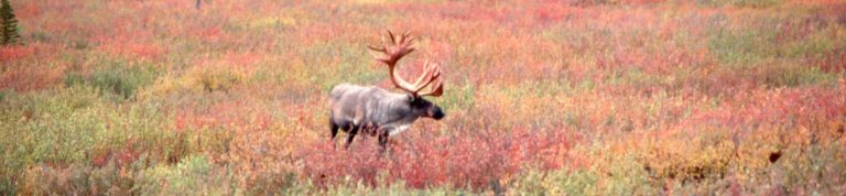
Man is a relative newcomer to the Great Land. He probably came across the Bering Land Bridge during the last major Ice Age, roughly 12-18,000 years ago. The oldest hunting campsites in the Yukon, near Tombstone Park, (shown above), are dated around 8-10,000 years ago.

The land of Beringia was the home to legendary beasts like the woolly mammoth, the sabre-tooth tiger, and the giant beaver. In fact, woolly mammoth tusks are often unearthed in construction sites and mining operations throughout Alaska and the Yukon. There is an excellent Beringia Museum in Whitehorse, capital of the Yukon Territory, which describes this singular moment in natural history. A great book on the “discovery” of the Bering Land Bridge is The Last Giant of Beringia![]() .
.
Beringia stretched from Asia, across Alaska, and into the Yukon Territory, where it was bounded by the massive Cordilleran Ice Sheet covering most of North America. As the Ice Sheet retreated, these Asian immigrants settled throughout the region in seven major nations. Check out www.alaskanative.net, and visit the Alaska Native Heritage Center near Anchorage, for the best resources on these cultures.
The first Europeans were Russians, also coming by way of Siberia. Vitus Bering, on orders from Czar Peter the Great, reached Alaska in 1741. Unfortunately, he did not live to garner the glory. However, some of his crew came back with seal and sea otter pelts that spawned a gruesome industry that practically wiped out both species. James Michener’s By James A. Michener: Alaska![]() is of my favorite books on Alaska. It has a well-research re-imaging of Bering’s adventures.
is of my favorite books on Alaska. It has a well-research re-imaging of Bering’s adventures.

The indomitable British explorer, James Cook, made it to Alaska on his third and final voyage in 1778. Alaskan maps are littered with pithy place names like “Disappointment Bay” left behind by the captain. He was looking for the Northwest Passage and kept registering his frustration with the help of his cartographer. His adventures are admirably described in Blue Latitudes: Boldly Going Where Captain Cook Has Gone Before![]() .
.
One of Cook’s former mates, George Vancouver, brought his own ship to the Inside Passage in 1794, when the Pacific Glacier completely filled what is now known as Glacier Bay. This was a time of a mini-ice age. It is no wonder General Washington had been freezing his buns off at Valley Forge sixteen years earlier. Winters were colder then.
By the end of the Crimean War with Britain, (1858), the cash-strapped Russians were looking to contain the British expansion in Canada. So, they put their Alaskan colony up for sale. By 1867, the Americans were ready to purchase the unknown territory site-unseen. A short ceremony was held at Sitka where the American red, white, and blue, replaced the Russian red, white, and blue. The Sitka National Historical Park commemorates the site and deed.

The early American exploration of Alaska could be described as “astonishing men on astonishing adventures.” The first of these was the Californian, John Muir. Already a veteran of Yosemite and Yellowstone, Muir set off in 1879 for Alaska to continue his life-long research of the effects of glaciation. Sure enough, he found himself in Glacier Bay and returned to excite the imagination of other explorers. His Travels In Alaska![]() is one of the most inspiring classics in Alaska Literature. (Some Kindle versions are free.)
is one of the most inspiring classics in Alaska Literature. (Some Kindle versions are free.)
Muir returned to Alaska four more times. The last trip, the 1899 Harriman Expedition, was considerably more upscale. It was the first organized Gulf Cruise, all the way to College Fjord, (whose glaciers they named after the collegiate sponsors of the expedition), and, of course, Harriman Fjord, both of which remain stunning cruise experiences today. The trip is chronicled in Looking Far North: The Harriman Expedition to Alaska, 1899 (Princeton Paperbacks)![]() .
.

By 1888, the mountaineers had entered the picture. As the only observed knowledge of Alaska at the time was that which could be seen from the rail of a sailing ship, the prevailing notion was that Mt. St. Elias, at 18,008 ft., was the tallest mountain in North America. This beautiful peak anchors the St. Elias range that forms the forbidding northern shore, (actually, more like a 20 mile long, 12,000 ft. high wall of continuous peaks), of Yakutat Bay. The peak appears to rise almost from sea level, towering over the massive Malaspina Glacier, which is so flat, it can hardly be seen from the ship.
With the naïve audacity of a mythic hero, up stepped I. C. Russell, along with half a dozen unsuspecting supporters. They were “dropped off” on the northern shore of Yakutat Bay with the intention of traversing the ice cap and scaling Mt. St. Elias. After six weeks of glacier living, not only did they fail miserably, enduring frightening climate and conditions, they happened to notice a taller mountain further inland. They had just discovered Mt. Logan, the tallest peak in Canada, just 500 feet short of Mt. Denali. It also happens to be considered the most massive mountain, above water, in the world.
Russell was a mite disappointed. So, he named a nearby fjord after himself and retreated. His journals comprise some of the very first editions of National Geographic Magazine. NG has done us all the favor of compiling their entire collection on DVD’s, which will give you access to these journals, as well as several other wonderful articles on Alaska, like contemporary reporting of the Klondike Gold Rush and many other discoveries. (The Complete National Geographic – 125 Years (1888 – 2012)![]() )
)

After the mountaineers came the prospectors. Encouraged by small strikes in places like Juneau, these singularly anti-social souls wandered throughout the Great Land looking for Eldorado North. Darned if they didn’t find it near the confluence of the Klondike and the Yukon rivers. This was, of course, one of the most important native fishing settlements in the Great Land.
The prospectors bullied the Tr’ondek Hwech’in native population into submission and proceeded to dig up every square inch looking for the Mother Lode. The native story, told in their own terms and perspective, is an important read for anyone traveling through the Yukon. The tensions created in 1898 continue to this day and are reflected in the politics of the region. The book is called Hammerstones: A History of the Tr’ond’ek Hw’ech’in![]() . If you can’t find it online, you may have to wait to purchase it at the Danoja Zho Cultural Centre in Dawson.
. If you can’t find it online, you may have to wait to purchase it at the Danoja Zho Cultural Centre in Dawson.