If you take a flight from Jeddah, Saudi Arabia, to Europe, the plane will take off to the west over the Red Sea. The pilot will continue due west, over the sparkling waters until hitting landfall near the Egypt-Sudan border. The land here looks like the moon. It is dark, rocky, and mountainous. As far as you can see, from 30,000 feet, there is nothing but barren, forbidding expanse. Finally, the mountains start to relent. The terrain flattens and a large lake comes into view. This is Lake Nasser, the result of the building of the Upper Aswan Dam.
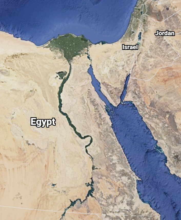
The plane then banks to the right and follows the thin blue/green line north along the Nile to Cairo. On either side of the river, most of the way, there is dark red rock or golden sand and very little else. If you look closely, occasionally, you will see the triangular shadow of an old pyramid.
If your plane has a stopover in Cairo, you may get a bird’s eye view of the Pyramids and Sphinx on the Giza plain just outside the city sprawl. Even in the 21st Century the Nile is a highway, for airplanes, too. A stunning, visual introduction to this unique land and its culture is Egypt From The Air, by Marcello Bertinetti.
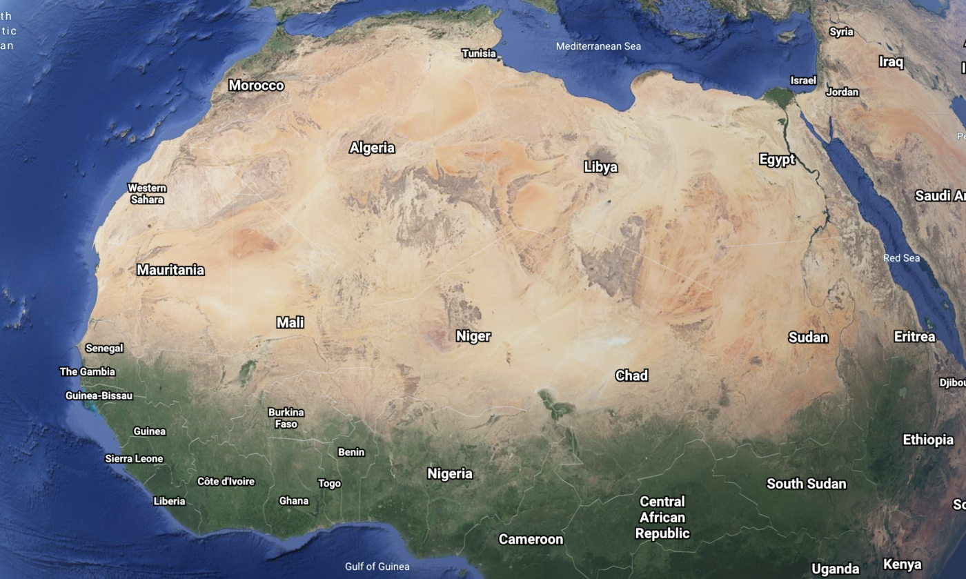
As we begin a discussion of one of the oldest civilizations on earth, we must introduce the natural phenomena that define Egypt. There is the vast, hot, dangerous desolation of the rocks and dunes of the Sahara and the narrow, reliable, life-sustaining current of the Nile. The river has made life, trade, transportation, and spirituality possible in this relentless wasteland. Aside from the major oases in the western desert, the development of all layers of this civilization over thousands of years has taken place within sight of the river banks of the Nile.
It wasn’t always like this. Parts of the desert used to be ocean bed. Some of the oases are salt water and there are great salt beds and land forms that commemorate that geologic time. Since the last ice age, 10-14,000 years ago, up to about 3,600 years ago, the Sahara was covered with hospitable savannah. The theory is that the precession of the earth around its axis has caused the slow climate change that raised the heat and lowered the rainfall creating the desert we now know.
This process also drove some of the migration patterns of early man, as described in National Geographic’s Deep Ancestry: Inside The Genographic Project and its recent sequel, The Journey of Man: A Genetic Odyssey (Princeton Science Library)
. The books describes DNA patterns in the world populations and have the side benefit of identifying some of the major migration trends of prehistoric man. The evidence suggests that the earliest humans walked out of tropical Africa through Egypt to Europe and Asia. It is possible the Nile was an important highway for these travelers.
To orient yourself to the jargon of Egypt, you may have to stand on your head. The Nile flows northward, from the tropical highlands to the delta low lands. So, when looking at a map, the “Upper Nile” is below the “Lower Nile,” and “Upper Egypt” is below “Lower Egypt.” The history of Egypt has included fairly consistent tension between the two Egypt’s. So, it’s important to keep them in their place.
Lower Egypt includes the Nile Delta, south along the river as far as the al Fayyum Oasis, as well as the Sinai Peninsula. The major locales are Cairo, Giza, Saqqara, and Alexandria. The last traces of Memphis and Heliopolis are here also.
Upper Egypt is centered around the ancient city of Thebes, or modern-day Luxor, about 300 miles south of Cairo. The city is on the east side of the river and includes the temple complexes of Luxor and Karnak. In the low mountains west of the river are the Valleys of the Kings and Queens, and the other famous burial tomb sites of the later dynasties. Further up river (south) from Luxor are the temple sites of Esna, Edfu, Kom Ombo and Aswan, the site of the Aswan dams that have formed Lake Nasser. The lake flooded most of what was the ancient kingdom of Nubia. A number of Nubian temples and the famous statues of Ramesses II at Abu Simbel were relocated above the eventual water level of the lake to preserve them.
The Nile empties into the Mediterranean Sea across a wide delta. Over time there have been as many as five different river channels through the delta. Today, there are two. The delta has always been very fertile from the silt. Early migration to and from the Fertile Crescent area of modern day Iraq, Syria, and Israel, brought back domesticated grains and livestock that were easily sustained in the lush delta. As described in Jared Diamond’s classic, Guns, Germs and Steel, the concentration of natural grains that somebody figured out how to harvest is higher in the Fertile Crescent than anywhere else in the world. The possibility of crop cultivation transformed human existence from solely hunter/gatherer to sedentary farmer. People started to accumulate in places where grains could be grown. Slowly, civilization was born.
.) It was the grain production of Egypt that attracted the attention of the Roman Empire, centuries later, to feed its burgeoning capital.
Meanwhile, up river, in modern-day Sudan, fertile land near the third Nile cataract (rapids) was also cultivated about 5000 BCE. This would lay the ground work for the kingdom of Nubia, which would become “Upper Egypt.” Independent settlements existed along the Nile. Somewhere around 3200 BCE, the first hieroglyphics were invented. By 3150 BCE, the First Dynasty of King Menes ruled over a united upper and lower Egypt, the start of the “Old Kingdom.”

