One of the common misconceptions about South America is that it is actually south of North America. It is not. It’s so far to the east that only the very western tips of Ecuador and Peru are also west of Miami. While it may be slowly drifting westward, it won’t be due south of us for a merry while.

South America has many distinct geologic features that will show up in the cruise itineraries sailing around the continent. Open up your National Geographic Visual Atlas of the World, 2nd Edition: Fully Revised and Updated.
Let’s start with the Andes. Second in height only to the mountains rimming the Tibetan plateau, the Andes rise like a spine along the west coast of South America. They wind from the very northern tip of the continent in Venezuela to the more well-known southern tip in Tierra del Fuego, Chile.
The Andes are formed by the continuing subduction of the Nazca plate (from Columbia to mid-Chile) and the Antarctic Plate (southern Chile) under the South America Plate.
While the mountains go up, the Atacama Trench goes down, as far as 26,000 feet deep. This trench runs the length of the western coast and has the cold Humboldt Current and lots of fish. Trekking along the Andes is a traveler’s adventure all on its own: Andes.
The mountains and the cold current create an interesting natural double whammy. The prevailing weather pattern is east to west. Winds coming over the tropical eastern continent pick up moisture and dump it in the Andes where it can run back down into the jungle and repeat the cycle. This creates a rain-shadow in the high plateaus west of the mountain crests. At the same time, the cold Humboldt Current keeps any precipitation from forming from the westerly direction. The result is one of the driest places on earth, the Peruvian Plateau. How dry is it? It’s so dry it is used by scientists and astronaut training as a proxy for the surface of Mars.
You can tell that it looks like some action of plate tectonics has pushed the continental connection to the right, leaving Drake’s Passage in between.
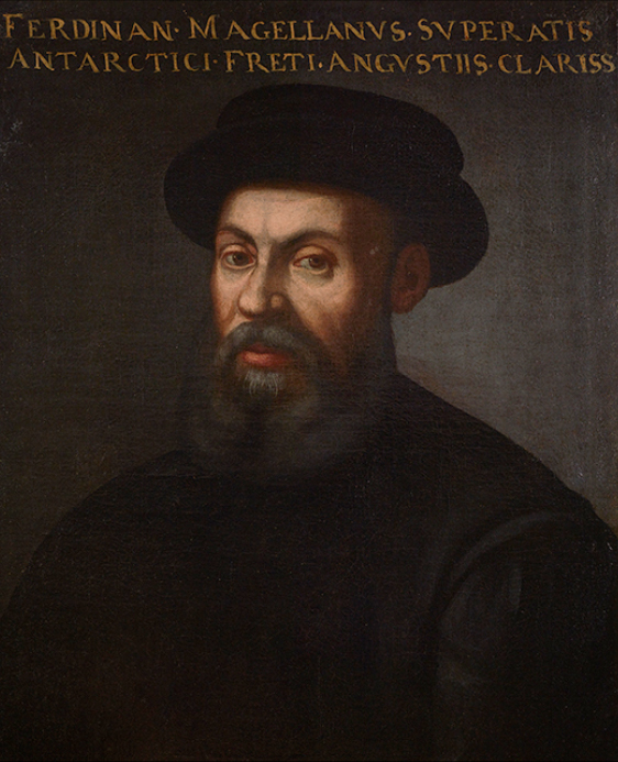
As the southern Andes drop into the ocean, you’ll have days of dramatic coastline scenery with fjords, cliffs, and glaciers that rival those in Alaska and Norway. The first European to enjoy the view was the Spaniard, Ferdinand Magellan, in 1520. As you pass through the Strait with his name on it, imagine sailing through here on a wooden ship roughly 70 feet long, with 55 other men aboard who have been sailing for more than a year and who are already mutinous. Over the Edge of the World: Magellan’s Terrifying Circumnavigation of the Globe
There is an excellent book called 1421: The Year China Discovered America, about imperial fleets from China who sailed the world’s oceans between 1421 and 1423. Their history was erased by the reclusive emperor who took charge after they departed. The research suggests that one of the fleets rounded Cape Horn and created charts that subsequently made it to the navigators of Europe. Magellan may not have been flying blind. He may have had a map!
There are two types of rivers that cascade from the Andes. Westward flowing rivers are short and charge dramatically down to the Pacific. They will figure prominently in our next article about ancient civilizations. Eastbound rivers, from Bolivia northward (the wide part of the continent), flow into the Amazon. The Argentinian Andes rivers run off into the watershed of the Rio de la Plata.
Most of the massive Amazon basin lies between the equator and the first ten degrees of southern latitude. This is the famous tropical jungle referred to as the “lungs of the world” and home to some of the most intense biodiversity on the planet. Small to medium-sized cruise ships can sail into the heart of the continent up to Manaus. It has been a destination for adventurers from conquistadors, River of Darkness: Francisco Orellana’s Legendary Voyage of Death and Discovery Down the Amazon, to US presidents, The River of Doubt: Theodore Roosevelt’s Darkest Journey
, to inquiring scientific minds, One River
.

It is possible that we do not understand the Amazon Jungle well at all. In the chapter called “Amazonia” in 1491: New Revelations of the Americas Before Columbus, by Charles Mann, (not to be confused with 1421, by Gavin Menzies), much of the Amazon may be the remains of historic agricultural efforts from ancient times. It is probably not the pristine natural habitat we have imagined. There is fascinating evidence of many small societies who found ways to adapt the vegetation for periods of time but who did not last. Regardless, it still remains an important place for the appreciation of the natural world.
There are specialty cruises that visit Venezuela’s Orinoco Delta. The attraction is wildlife ranging from pink dolphins and rare crocodiles, to monkeys and toucans. Tucked back in the highlands of Venezuela, the tallest waterfall in the world, Angel Falls, will be available on a flight excursion. It was originally sighted by American Jimmy Angel, and bears his name.
Further south, on the Argentinian/Brazilian border, the Iguazu River drops 200 to 250 feet over a horseshoe shaped fault creating the largest set of cataracts in the world at Iguazu Falls. The breadth of the vista is astonishing, not to mention the mist and noise. It is an unforgettable sight. Even more surprising is the abundance of brilliant butterflies that inhabit the jungle and are visible everywhere as you approach the falls.
Finally, we must mention the Galapagos Islands. A treasure of Ecuador, these volcanic islands protect their fabled indigenous species, including marine iguanas, penguins, boobies, tortoises, and Darwin’s famous finches.

Charles Darwin visited the islands during the five-year world exploration of the HMS Beagle, 1831-36. He published his observations in 1839 as The Voyage of the Beagle (Wordsworth Classics of World Literature). However, it wasn’t until he and his colleagues examined his specimens, particularly the finches and their beaks, that he began to voice his thoughts about evolution.
In 1845, his second edition was revised to include his theory of natural selection. It took him until 1859 to publish On the Origin of Species, setting off scientific and theological debates that persist today.
The islands are formed by volcanic activity on a “triple junction” of three tectonic plates. They also sit on a “hotspot” opening in the Earth’s crust. It is the perfect place to gain an appreciation for many of the incomprehensible forces that shape our planet and its life.


